Precision Drone Solutions for Complex Oil & Gas Challenges

Whether it’s tanks, towers, or pipelines—our drones inspect, map, and monitor with zero compromise on safety.

Why Birdseye? Because Flat Data is Outdated

At Birdseye, we don’t just scan landscapes—we decode them. Our platform fuses drone photogrammetry, LiDAR, and AI to deliver volumetric insights that are: 

Start Growing Your wealth with eclipse

All-in-one personal finance app that simplifies investment opportunities, expense tracking, and financial news for users

Automated Expense Tracking

Eclipse automatically tracks your expenses and provides a monthly report, in just a single click.

Investment Opportunities

Eclipse provides you with the best investment opportunities in Mutual Funds and FDs.

Latest Financial News

Eclipse provides you with the latest financial news and market trends.

Advance Tax Calculator

Take the guesswork out of your tax calculations with advanced tax calculator

Eclipse Education (For Users)

Eclipse Education is a fintech blogging platform for users to learn about finance and investments.

Eclipse Education(For Writers)

A fintech blogging platform for writers to showcase their work in finance and investments.

What You Gain

Precision Without the Pain

Eliminate manual measurements and guesswork. Achieve exact volume calculations in just minutes, not hours.

Time Back on Your Clock

Automated workflows accelerate decision-making and reduce project delays by up to 40%.

Data That Talks to Your Tools

Seamlessly integrates with GIS, BIM, and major project management platforms—no extra formatting or conversions needed.

Track Change Over Time

Compare historical scans to monitor progress, erosion, or material shifts with up to 98% accuracy.

Probe specifications summary

Probe Frequency

Ideal for

7.5 Mhz

Thin walls, small pipes

5 Mhz

General purpose

2 Mhz

Thick walls, dirty surfaces

Industry 

Use Case

Construction

Cut/fill analysis, site grading, material tracking 

Mining 

Stockpile measurement, pit volume, compliance reporting

Agriculture 

Biomass estimation, terrain modeling, yield forecasting

Forestry 

Canopy volume, deforestation tracking, carbon analysis 

Environmental

Coastal erosion, flood modeling, landform change 

Urban Planning

Infrastructure modeling, zoning analysis, 3D mapping 

Reimagine Your Projects With 3D Excellence

Partner with us today to capture, model, and transform your vision into reality.

Case Studies

Oil & Gas

Saving $600,000 On COT Inspections With The Elios 3 UT

Oil & Gas

Cutting Costs by 60% for Pipe Rack Inspections with the...

Oil & Gas

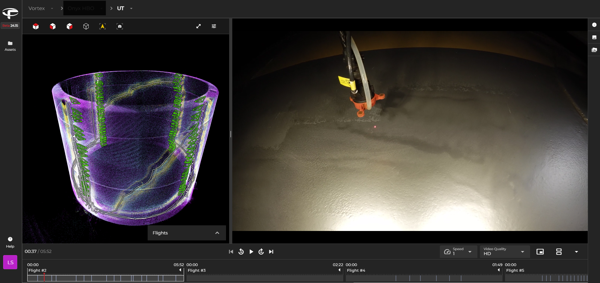
Tank Ultrasonic Thickness Measurement With The Elios 3